
Ever wonder about how drones have become a critical part of the narrative of so many search and rescue missions? The role of drones in search and rescue missions is crucial. The unique narrative each mission creates, invites creativity in unit planning with drones and math. In this unit, the narrative begins in Fairmount Park in Philadelphia and challenges students to connect coordinate graphing and area/perimeter to coding and operating drones. Providing students with this unique opportunity to think creatively in their problem-solving, this unit also asks students to learn more about issues related to drone use that are often not raised as topics of discussion: 1) privacy within underprivileged communities, 2) relationships between police, drones, and the community they serve, as well as 3) accessibility, and the technology innovation gap. There are hopes that this unit will allow students to see themselves in the math they complete as we connect our work for the project to drone use and drone technology business owners who are members of the global majority. At the same time, students will investigate themes related to drone accessibility amongst those in lower socioeconomic groups and the funding needed to become a licensed UAV pilot. A culminating project hopefully will merge much of what students learned throughout this unit.
“For more than two weeks, search-and-rescue teams in Colombia have scoured the Amazon rainforest for four children who were aboard a plane that crashed on May 1. The bodies of the three adults on board were found in the wreckage, but there was no sign of the children.” May 18, 2023, New York Times Drone use for search and rescue is not limited to the Amazon rainforest. Most recently it has been used to locate Danelo Cavalcante, the 34-year-old man who escaped from a Chester County, PA prison (Steib, 2023). They were also useful in locating the remains of 9-month-old Conrad Sheils (Moran, 2023), whose tragic story of being swept away from his family’s car during a flash flood, left many uneasy. On a more comical side, a drone was used to lure a runaway dog (Spray, 2022) in England from a dangerous marsh. Comically, the dog was lured with a freshly cooked sausage tied to a drone to a safe recovery. Search and recovery is where my thoughts rested after my Teachers Institute of Philadelphia sessions on drones and their educational usefulness. In these sessions, we received a well-rounded understanding of drones. We began with instruction on the basics of flight and reviewed relevant equations necessary such as the equations for Lift, Newton’s Second Law, and Motion. Drone safety was key to beginning to use our drones and expanding our knowledge to our students in our respective classrooms. The instruction and practice we received in flying and programming our CoDrone EDU drones with Blockly is one lesson I deeply valued. It was through my lessons with Blockly and through our TIP sessions that I decided to include Blockly lessons in each day of my unit. We continued our instruction by learning about the varied uses of drones as well as their professional abilities through the presentations of two guest speakers. One peripheral lesson I learned is that there is a great deal of math involved in the structure, flight, coding, and manning of drones! Learning about the name of a vehicle with four propellers, quadcopters, was fun, while it was also fascinating to use angles, variables, and conditionals (if-then statements) in the coding of drones. This relationship between drones and math allowed me to marry a drone search and rescue mission narrative with mathematical content used within a fifth and sixth-grade curriculum. I wanted to see how I could connect coordinate mapping, metric measurement, scale drawings, and the costs incurred from drone mapping and/or search missions to flying a drone. The connection I sought led me to the largest park in Philadelphia. Search and rescue with drones is typically performed in a forest or large wooded area. Philadelphia is not equipped with a conventional forest. In fact, the closest forest to the Art Museum in Philadelphia is Wharton State Park, over 25 miles away in southern New Jersey. Heading west, one can find William Penn State Forest, almost 70 miles and an hour and a half drive from the Art Museum in Philadelphia. Therefore, to make this unit relevant to students at the School District of Philadelphia, we located our largest urban forest, one of which many Philadelphians affectionately known as Fairmount Park. Fairmount Park was created in 1855 as a refuge and a way to preserve green spaces in Philadelphia. Situated on the banks of the Schuylkill River, and covering more than 2,000 acres, it is the largest park in Philadelphia. Once a part of the Lemon Hill estate, it was sold to Philadelphia by the Pratt (Henry) family in 1844. The park includes Wissahickon Valley Park, Pennypack Park, Cobbs Creek Park, FDR Park, and more than fifty additional parks, parkways, plazas, and squares throughout the city. Fairmount Park will be the base for our mathematical narrative. The culminating project for this unit exists in two parts. First, students are asked to act as the owner of a drone technology company. As an owner of this company, students are expected to create a pitch to convince Philadelphia’s Fire and Police commissions to utilize drones in their work and service to the community. As a part of their pitch/presentation, they will share previous rescues their company has made in Fairmount Park. In their presentation, students are expected to: In the second part of the project, students will share their code for the rescue of one or more of the three targets, and run their code on a larger scaled version of Fairmount Park. Students will be graded on how convincing and creative they are with their presentation, and at the same time, they will demonstrate their level of understanding of Area, Perimeter, Coordinate Graphing, scale mapping, and metric measurement. Within this unit, I hope your students and mine will engage in peripheral discussions surrounding the cost of drones, and their ethical use. I also hope students will be able to identify issues of justice, equity, diversity, and inclusion (Louise Derman-Sparks) in their access, with privacy concerns, and concerning community policing. Written in the style of Understanding by Design (UbD), this project/unit is intended to “deepen and develop” student understanding in a way that is fluid, not rigid. Please note, that the UbD framework presented here has been modified to include a framework to consider Justice, Equity, Diversity, and Inclusion as proposed by the work of Louise Derman-Sparks. It also leaves room for the tenets of Ghouldhy Muhammad’s framework in daily classroom lessons to support culturally responsive learning.
This story made headlines in the New York Times, and at the same time, it touched the hearts of many who followed the story to its end. Investigations into drones and drone technology allow one to wonder how the use of a drone might have aided in the search and recovery of these four children. Drone use is multifaceted. Known as Unmanned Aerial Vehicles, this technology has been used for package delivery, wildlife surveillance, inspections of infrastructure, and search and rescue, to name a few (cite Internet of Drones). Given the multitude of uses for UAVs, it is easy to imagine that these vehicles would serve great use for search and rescue missions in the Amazon forest. Despite its almost indispensable use in many facets of life, it is difficult to locate scholarly studies documenting or studying drone use /usage below the canopy of the Amazon rainforest.
This unit is an inquiry and project-based unit where students receive direct/explicit instruction on a mathematical concept. They are then asked to apply the concept to a project or real-world-based challenge where to produce something that demonstrates their learning and understanding. The project is outlined in the link: Go Seek! Drone Rescue and Recovery, and require students in groups to create a presentation to convince Philadelphia’s police and fire commissioners to hire their drone company for search and rescue missions throughout Fairmount Park. The project will act as the Summative Assessment for this unit. After completing the entire project, students are asked to reflect on the entire three-week process; its design, implementation, and the value of the project in a project reflection document. Explicit Instruction Explicit and Direct instruction and practice will be used to teach and review concepts surrounding Coordinate Graphing, creating polygons on the Cartesian Coordinate graph, and determining the Area of such polygons. This work will then be used to simulate three rescue missions. What is not explicitly stated in the project is that students will also be required to determine the distance from one rescue mission to the next based on the scale factor of a smaller (gridded) map of Fairmount Park and a larger one we will create for our drone programming and flight demonstration. In many classes throughout Philadelphia, for math, there can be a range of math abilities within one class. Within one sixth-grade class, I have had students who were on math levels from second to seventh grade. Given this is often the norm, methods of differentiation must exist in the multi-talented classroom. In my sample lesson, I noted that one of the introductory assignments of plotting numbers on a coordinate graph existed for students who were at an advanced level and slight modifications for those who required less of a challenge. Group Discussion Through group discussions of various math and drone narratives, our class will gain an understanding related to drone access to the Global Majority, how power and wealth are related to that access, as well as the distribution of wealth amongst various police and law enforcement districts. The relationship between drones, math, power, laws, and wealth all assist in Gholdy Muhammad’s model of culturally responsive learning.
Math Project: Go Seek! Drone Rescue and Recovery Last month you were hired by Philadelphia’s Police and Fire Departments to assist with search and rescue missions with your thermal imaging drone. Within the last month, you were involved in three rescue missions: One for a family pet, the other for an older man with Alzheimer’s, and the third for a lost child. You are trying to gain funding for your services for another month, and have to make a presentation to the Police and Fire Commissioners of Philadelphia. These two people and their staff will be directly responsible for funding your work with the Police and Fire departments if they realize how critical it is to the general community. Describe each mission by sharing: As you prepare your research, consider how you can share information about the history of Fairmount Park and answer the following Essential Questions: 5.G.A.1 — Use a pair of perpendicular number lines, called axes, to define a coordinate system, with the intersection of the lines (the origin) arranged to coincide with the 0 on each line and a given point in the plane located by using an ordered pair of numbers, called its coordinates. Understand that the first number indicates how far to travel from the origin in the direction of one axis, and the second number indicates how far to travel in the direction of the second axis, with the convention that the names of the two axes and the coordinates correspond (e.g., x-axis and x-coordinate, y-axis and y-coordinate). 5.G.A.2 — Represent real-world and mathematical problems by graphing points in the first quadrant of the coordinate plane, and interpreting coordinate values of points in the context of the situation. × 102 = 400 Example 2: 0.05 ÷ 103 = 0.00005 Understand that attributes belonging to a category of two-dimensional figures also belong to all subcategories of that category. For example, all rectangles have four right angles and squares are rectangles, so all squares have four right angles. 6.NS.C.8 Solve real-world and mathematical problems by graphing points in all four quadrants of the coordinate plane. Include use of coordinates and absolute value to find distances between points with the same first coordinate or the same second coordinate. Draw polygons in the coordinate plane given coordinates for the vertices; use coordinates to find the length of a side joining points with the same first coordinate or the same second coordinate. Apply these techniques in the context of solving real-world and mathematical problems. Find the area of right triangles, other triangles, special quadrilaterals, and polygons by composing into rectangles or decomposing into triangles and other shapes; apply these techniques in the context of solving real-world and mathematical problems. (What thought-provoking questions will foster meaning-making, inquiry, and transfer?) ● How might a drone use math for a search and rescue in your neighborhood? ● What is the technology innovation gap? How would knowing or including this information in your presentation be of benefit to you and your company? ● How can drones be used to strain and improve the relationship law enforcement has with the community in which they serve? (What facts and basic concepts should students know and be able to recall?) · Drones are cool! · Learning how to fly drones can have applications for the future with high payoffs. · There are issues of justice and equity surrounding drone flight as well as search and rescue. · What are the laws surrounding drone flight? How can laws for flying drones harm or alienate a group of people? (What skills and processes should students be able to draw upon and use?) To succeed at this project, students will be expected to know… · about the coordinate plane, the x and y axes, and how to plot a coordinate on a coordinate plane in all four quadrants · how to determine the area and perimeter of triangles and quadrilaterals. · scale and proportion (review from a previous unit) · metric length and distance (at a minimum level) The JEDI framework is one included with my personal UbD’s to remind me to look for issues of Justice, Equity, Diversity, and Inclusion in all of my units. I am not always successful at including all four, but including three of the four adds an element of this unit which is inclusive of many different types of people. Justice: Discussions of the rights of those with drones and the rights of the average citizen when police utilize drones to serve the community for which they work. Equity: Drone access to women, the poor, and those of the global majority. Diversity: In week three students are expected to research drone companies within Philadelphia and those owned by people of the global majority. This research and subsequent sharing afterward is not only a way to bring joy to students who complete this research but also allows some students to see themselves within their math work. Inclusion: Sometimes simply working through the JEDI framework allows many different groups of students and people to be represented within their math work. However, more could be done within this unit to explicitly include learning and physical differences and how they relate to drone use. (What criteria will be used in each assessment to evaluate attainment of desired results?) (What assessment(s) will provide understanding and meet other Stage 1 goals?) ● Students will be presented with a Standards Quiz to test their ability to ● plot shapes on a coordinate plane ● determine the area and perimeter of a polygon on the coordinate plane ● Students will complete a project that incorporates drones, search & rescue, and math. ● Project Description and Rubric: Go SEEK! Drone Search and Rescue Other Evidence (What other evidence will be collected and evaluated to ensure that Stage 1 goals have been met?) Daily graded classroom math exercises, discussions, and problem-solving will determine additional evidence of learning. Students will also receive training in flying a drone. This project is inherently leading to lessons on long division and proportions for 6th grade. Both of these can be incorporated into the current project for additional challenges. Introduction and Project Preparation a) Usefulness of Drones in Search and Rescue: Introduce Danelo Cavalcante’s escape from Chester County Prison. b) Infrared Drones Responsible for Saving over 20 Lives in Sumter County, Fla i) Can every police district purchase a drone? c) Philly Considering Drones for Community Policing i) What are some of the challenges of Philadelphia Police using drones for Policing? ii) What are some of the benefits of Philadelphia Police using drones for Policing? Math Instruction a) Coordinate plane vocabulary i) coordinate plane, x-axis, y-axis, origin, plane, quadrants, ordered pairs ii) Identifying given locations on a coordinate plane b) Coordinate Plane Practice i) Level 1: Graphing in Quadrant 1 ii) Level 2: Graphing in all four Quadrants iii) Level 3: Graphing to make a figure, design, or shape in the 1st Quadrant or all four quadrants c) Coordinate Plane Practice i) DESMOS: The Coordinate Plane Activity ii) DESMOS: Pac Man and Coordinate Plane (advanced) e) Distance between points. Graphing Shapes on the 1st quadrant. Graphing shapes on all four quadrants. f) Drawing Polygons and composite figures on the Coordinate Plane Drone Training: a) 1.1 Pairing and Coding: 1.1 Pairing and Coding w. Blockly: b) 1.2 Flight Events: https://learn.robolink.com/lesson/1-2-flight-events-junior-cde-blockly/ c) 1.4 Variables: https://learn.robolink.com/lesson/1-5-variables-junior-cde-blockly/ d) 1.5 Conditionals: https://learn.robolink.com/lesson/1-4-conditionals-junior-cde-blockly/ e) Free Exploration or Catch-Up SAMPLE LESSON PLAN (Day 1) Project Preparation a) Multifaceted World of Drones b) Eyes in the sky; FAA Regulations on Drone Flight c) So You Want to be a Commercial Drone Pilot? Math Instruction: Area and Perimeter Review a) Area and Perimeter (small numbers, large numbers, simple and complex decimals, fractions, and mixed numbers) b) Perimeter and Area on the Coordinate Plane i) Illustrative Math: Perimeter and Area on the coordinate plane. ii) DESMOS: Find Area of Polygons iii) DESMOS: Polygon Perimeter and Area c) Area of Triangles, Trapezoids d) Area of Composite Figures e) Area of Circles (advanced) Drone Training: a) 1.6 Loops- https://learn.robolink.com/lesson/1-6-loops-junior-cde-blockly/ b) 2.1 Flight Events- https://learn.robolink.com/lesson/2-1-flight-events-senior-cde-blockly/ c) 2.2 Flight Directions- https://learn.robolink.com/lesson/2-2-flight-directions-senior-cde-blockly/ d) 2.3 Variables- https://learn.robolink.com/lesson/2-4-variables-senior-cde-blockly/ Project Preparation a) What is the “technology innovation gap” in communities of the Global Majority (Minority, BIPOC)? b) Drone Companies in our area (Philadelphia) c) Drone companies of the Global Majority d) Fairmount Park Investigation- Digital Guide i) Scavenger Hunt to learn more about the History 1) 4 Trails 2) Historic Houses 3) History of Park, Henry Pratt Math Instruction/Practice a) Standards Quiz Preparation i) Coordinate Graphing ii) Identify Coordinates of Houses on Cartesian Coordinate Grid Overlay of Fairmount Park iii) Area/Perimeter b) Scale and Scale Factor i) Enlarging a Photo Activities ii) Illustrative Math: What are Scaled Copies? 1) Corresponding Angles 2) 6.1 Scaling a Pattern Block iii) DESMOS: Scaling Machines c) Project Introduction Drone Training: a) Sensors Introduction: https://learn.robolink.com/lesson/3-1-sensors-introduction-cde-blockly/ b) Front Range Sensor: https://learn.robolink.com/lesson/3-6-front-range-sensor-1-cde-blockly/ c) Height Sensor: https://learn.robolink.com/lesson/3-4-height-sensor-cde-blockly/ d) Color Sensor: https://learn.robolink.com/lesson/3-8-color-sensor-cde-blockly/ e) Free Exploration or Catch-Up ● Project Work, Presentations, and Re-Submissions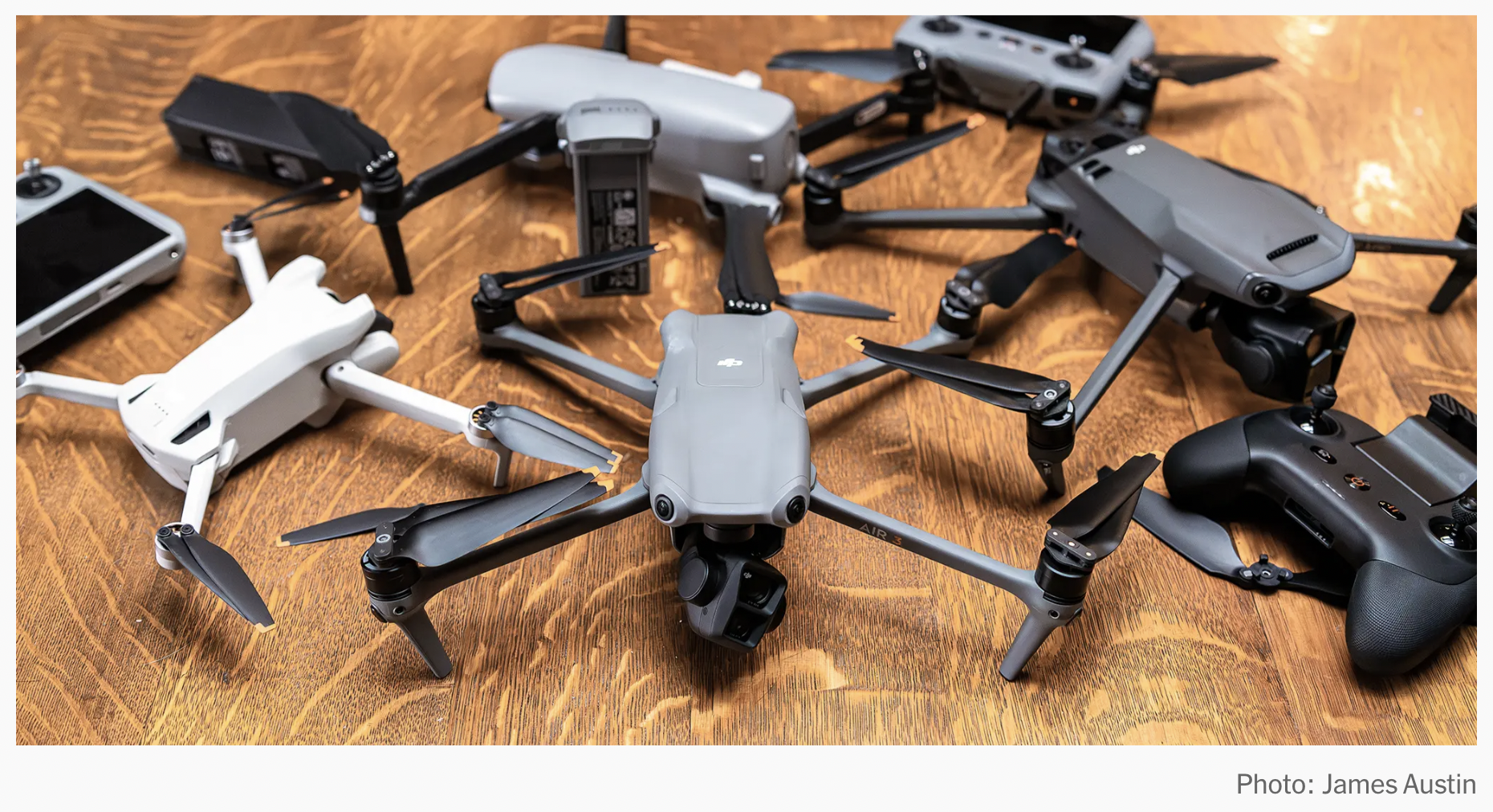
STAGE 1: Desired Results
Goals
Transfer
Content Standards
Students will use their math knowledge to determine how a drone can be programmed for search and retrieval missions.
Meaning
After completing the unit, students should be able to understand the connection between flight, geometric coordinates, scale, metric measurement, and area/perimeter.
Essential Questions
Acquisition of Knowledge and Skill
Students will know (learn)…
Students will be skilled at…
JEDI Framework
STAGE 2: Evidence & Assessment
Evaluative Criteria
Assessment Evidence
Performance is judged in terms of…
Transfer Task(s)
Where is this leading?
STAGE 3: Learning Plan
Week, Day, Submission of assignments
Activities and Notes
Resources
WEEK 1
WEEK 2
WEEK 3
WEEK 4
Resources
Aschwanden, Christie. “Lost in the Wilderness: Tech Tools Help But They Don’t Always Find Someone in Time: GPS, Cellphones, Infrared Cameras and Drones Have Improved Search and Rescue. Still, Finding Missing People in Forests or Jungles Remains a Difficult Task.” The Washington Post (Washington, D.C. 1974. Online), 13 Dec. 2019.
Bunch, Jesse. “The Philadelphia Inquirer (1969).” “These citizens are looking for escaped inmate Danelo Cavalcante. Police are not pleased.” The Philadelphia Inquirer, 11 Sep. 2023.
Dale, Maryclaire. “Search Intensifies for Children Swept Away in Philadelphia Flood.” Globe and Mail, 18 Jul. 2023, p. A4.
Daly, John. “GAME OF DRONES; From proposals of marriage to serving Mexican food, these unmanned aircraft are set to transform our civilization.” Daily Mail (London, England), 25 Aug. 2015, p. 13.
Darling-Aduana, Jennifer; Good, Annalee; Geraghty, Elisabeth. “The Culture of Power Online: Cultural Responsiveness and Relevance in Vendor-Developed Online Courses.” Urban Education (Beverly Hills, Calif.), vol. 57, no. 4, Apr. 2022.
Derman-Sparks, Louise; Edwards, Julie Olsen. “Understanding Anti-Bias Education: Bringing the Four Core Goals to Every Facet of Your Curriculum.” Young Children (YC), vol. 74, no. 5, Nov. 2019.
Dolata, Mateusz; Schwabe, Gerhard. “Moving Beyond Privacy and Airspace Safety: Guidelines for Just Drones in Policing.” Government Information Quarterly, vol. 40, no. 4, Oct. 2023.
Evaluating the Societal Impact of Using Drones to Support Urban Upgrading Projects.” ISPRS International Journal of Geo-Information, vol. 7, no. 3, 10 Mar. 2018, p. 91, https://doi.org/10.3390/ijgi7030091. Accessed 28 Mar. 2020.
Geoinformation; Investigators from University of Twente Report New Data on Geoinformation (Evaluating the Societal Impact of Using Drones to Support Urban Upgrading Projects).” Politics & Government Week, NewsRx, Atlanta, 2018, p. 323. Accessed 27 Dec. 2023.
Geiger, Vincent; Stillman, Gloria; Brown, Jill, et al. “Using Mathematics to Solve Real World Problems: The Role of Enablers.” Mathematics Education Research Journal, vol. 30, no. 1, Mar. 2018.
Gevaert, Caroline; Sliuzas, Richard; Persello, Claudio. “Evaluating the Societal Impact of Using Drones to Support Urban Upgrading Projects.” ISPRS International Journal of Geo-Information, vol. 6, no. 11, 2017, p. 343.
Goodnough, K., Azam, S. & Wells, P. Adopting Drone Technology in STEM (Science, Technology, Engineering, and Mathematics): An Examination of Elementary Teachers’ Pedagogical Content Knowledge. Can. J. Sci. Math. Techn. Educ. 19, 398–414 (2019).
Jacques, Sébastien, et al. “Multidisciplinary Project Based Learning Within a Collaborative Framework: A Case Study on Urban Drone Conception.” International Journal of Emerging Technologies in Learning, vol. 11, no. 12, 2016, p.36
Kellington, Wendie L. “Drones.” The Urban Lawyer, vol. 49, no. 4, fall 2017, pp. 667+. Gale General OneFile, https://go-gale-com.proxy.library.upenn.edu/ps/i.do?p=ITOF&u=upenn_main&id=GALE|A542244646&v=2.1&it=r&sid=summon&asid=f20604d9 . Accessed 26 Dec. 2023.
“Law enforcement drones: Privacy concerns v public safety.” Legal Monitor Worldwide, 6 Dec. 2014. Gale General OneFile, link.gale.com/apps/doc/A392567444/ITOF?u=upenn_main&sid=summon&xid=65b5b942. Accessed 27 Dec. 2023.
Lardieri, Alexa. “NYPD to Use Drones for Search and Rescue, Hostage Situations.” USNews.com, 5 Dec. 2018.
Leonard, Jacqueline, et al. “The nuances and complexities of teaching mathematics for cultural relevance and social justice.” Journal of Teacher Education, vol. 61, no. 3, May-June 2010, pp. 261+. Gale Academic OneFile, https://go-gale-com.proxy.library.upenn.edu/ps/i.do?p=AONE&u=upenn_main&id=GALE|A249309412&v=2.1&it=r&sid=summon&asid=708a6c3d . Accessed 26 Dec. 2023.
Leyva, Luis A.; Joseph, Nicole M. “Intersectionality as a Lens for Linguistic Justice in Mathematics Learning.” ZDM, vol. 55, no. 6, Nov. 2023.
Loyd, Lina. “Reactions Differ on FAA Rules for Commercial Drones.” The Philadelphia Inquirer, 17 Feb. 2015.
Melanie. “’Ted’s Great Adventure’: How South Jersey neighbors rallied to rescue a lost German shepherd.” The Philadelphia Inquirer, 30 Dec. 2020.
Moran, Robert. “Active Search Ends for Missing 9-Month-Old Lost in Deadly Bucks County Flood; Police Say Conrad Sheils Was the Last of Seven People Who Were Swept Away by Flash Flooding on July 15 in Upper Makefield Township.” The Philadelphia Inquirer, published Jul. 26, 2023, 5:03 p.m. ET.
O’Connell, Mary Ellen. “Game of Drones.” American Journal of International Law, vol. 109, no. 4, Oct. 2015.
Olson, Wyatt. “Search-and-Rescue Drones Could One Day Save Overboard Sailors.” The Stars and Stripes, The National Tribune, 22 May 2017.
Okubo, Kiichiro, et al. “Practice and Effects of Programming Education using Drones in the Agriculture Unit of the Fifth Grade of Elementary School Social Studies.” Journal Title, vol. 46, no. 1, 2022, pp. 157-169.
Radjawali, Irendra; Pye, Oliver. “Drones for Justice: Inclusive Technology and River-Related Action Research along the Kapuas.” Geographica Helvetica, vol. 72, no. 1, Jan. 2017.
Southall, Ashley; Winston, Ali. “Police to Deploy 14 Drones for Tasks Like Search-and-Rescue Operations.” The New York Times, 5 Dec. 2018, p. A28.
“Students’ Underwater Drone Could Aid Search & Rescue Missions.” Times of India, 3 Feb. 2019, Gale In Context: Global Issues, https://go-gale-com.proxy.library.upenn.edu/ps/i.do?p=GIC&u=upenn_main&id=GALE|A572182866&v=2.1&it=r&sid=summon&asid=42b74dc1 . Accessed 28 Dec. 2023.
Spary, Sara. “Stranded Dog Lured to Safety by Sausage Dangling from a Drone.” CNN, updated 1:09 PM EST, Sat January 22, 2022.
Stieb, Matt. “JUST ASKING QUESTIONS, Sept. 12, 2023: How U.S. Marshals Could Find Danelo Cavalcante.” Intelligencer, portrait of Matt Stieb, Intelligencer staff writer.
Stoica, Andrei-Alexandru. “Drones, Privacy and Data Protection.” Lex et Scientia, vol. XXVIII, no. 2, 2021, pp. 96-11
“WATCH: Surrey Search and Rescue from Drones Scouring County in Search of Missing People; Two DJI Phantom 3 Drones Fitted with a Thermal Imaging Camera Are Being Used by Surrey Search and Rescue to Help Trace Missing People.” Get Surrey (Surrey, England), 27 Jan. 2016.